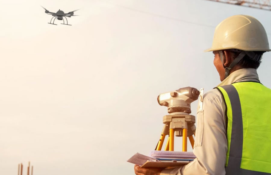
Drone Inspection Services.
Drones are like aerial vehicles to outdoor industries like agricultural, construction, engineering, filmmaking, delivery, mining, geology, insurance, chemical, etc. In these industries, the equipment can reach places that are almost impossible for inspection teams to carry out their inspection routine.
You can hire us to use our various technologically advanced and sophisticated drones for all your drone needs like military, engineering sites, camps, highrise buildings, highway roads, bridges, railways, telecom mast, high voltage pylons, towers, field works, aerial photography, oil rig, refinery, farm site, wildlife, conservation, emergency rescue, firm location, etc.
We can inspect internal and external facilities, onshore and offshore facilities, structures in multiple environments. This cost-effective and faster alternative is better than convectional scaffolding or crane inspections, which dangerous, expensive, and time-consuming.
Our drone technology has advanced sensors integrated into it, making it possible for us to capture the images from different perspectives to prevent detailed data loss. We use a variety of powerful drones like DJI Air 25, DJI FPV, DJI Pocket 2, DJI RS 2, Mavic 2 Enterprise Advanced, Agras T20. These drones are the industry's most sophisticated, most advanced drones. They capture the best photos and videos, with some of them having 4K resolutions.
We can perform inspection services as a regular service, as a one-off service, planned or pre-ordered, and on less than 24 emergency services.
Drone Aerial Tours Services.
One excellent service that we render is a virtual 360-degree video aerial tour. We'll shoot 360-degree imagery from an aerial vehicle, which can be combined with imagery taken on the ground through a video editing process.
Such comprehensive coverage is a way of detailing your products or services to prospective customers. And it can be deployed to showcase real estate development, vessels, shipping operation, golf course, recreational terrain, etc.
With the use of a video editor, we can add more information in the imagery to add extra value and other video editing bells and whistles to make the virtual tour enjoyable.
The Drone Aerial Photography.
Almost every industry can use the aerial imagery. Pictures taken from bird-eye vantage spot gets more attention and the coverage you want for some unimaginable details. Drone photography will also enable you to collect essential and actionable data on residential, commercial rooftops, and other assets.
Why do you want to settle for ineffective and uninspiring ground-level photos when aerial drone photography is within reach?
We specialized in creating aerial imagery in any region, be it sparse or dense areas, be it rural or urban.
As a result of our great options of aerial platforms, our drone pilots will always meet your requirements. We can work under pressure, produce high volumes of imagery, and operate in controlled airspace.
Aerial Survey and Mapping - Orthomosaic.
Our drones can produce advanced 2D maps and 3D digital elevation models that enable you to perfect imaging gaps uncompleted by satellite mapping.
Orthomosaic maps are geometrically correct aerial images that are composed of a large number of individual overlapping still images covering a defined area. When we capture the precise aerial images with geometrically calibrated cameras, we use proprietary software to stitch the imagery together into a georectified orthomosaic. We can also create 3D elevation and terrain models.
There are some benefits of using a drone for aerial survey and mapping over conventional aerial photography or GIS.
These are some of the advantages:
- Excellent picture resolution and accuracy compared to conventional aerial photography.
- Reduced cost (5 times cheaper) and field time.
- Fewer disruptions.
- Fast acquisition of data and deployment.
- Better accurate data and precise measurements.
- Fewer risk.
- It maps inaccessible areas.
- The operation and executed with ease.
With our photogrammetry expertise, we can obtain the height of any object. For every height, we can as well extract the coordinates. We can easily create a digital terrain model by using this information.
The superiority of the 3D digital terrain model is of high quality.
All the imagery can be seamlessly rendered into mosaic form (Orthomosaic) that can then be directly generated as GIS or CAD or GIS format that can be used for measuring purposes or mapping.
Digital Elevation Models.
Digital elevation models(DEM) or digital terrain models(DTM) are the topographic models of the natural earth that computer programs can alter. The data files contain a digital format of the elevation data of the terrain, which relates to a grid. With this data, a digital elevation model is created.
One of the benefits of a digital terrain model is that it allows for high-speed and efficient calculations.
Using digital terrain models, our professional drone team can evaluate the volume of stockpiles relative to ground zero. If we have two measurements over a while, we'll compute the difference in volume.
High-pressure in the Computations.
Our equipped Unmanned Aerial Vehicles with a high-resolution digital camera (48MP) are geometrically calibrated to perform high-volume measurements. These dimensions are predicated upon the standard of photogrammetry, whereby terrain heights are generated from a sequence of overlapping imagery.
This approach has many benefits over ground-level land-based survey methods. Some of the benefits are:
- It is accurate.
- It is Fast.
- It is safe.
- It is perfectly complete.
We can render the results in different ways. It ranges from a report signifying the stockpile volume to paper or digital maps and 3D models of the stockpile.
Usually, for the report to be created, it takes 12 hours to process all the survey results.
Before the aerial survey, we lay ground control points in the area of the stockpiles. More so, we measure some extra verification points used to check the quality of the measurements.
We also capture some photographs of the stockpile using one of our pre-programmed drones to follow a flight path and take the images at predefined locations.
We carefully choose the area of the photographs to obtain a significant overlap between the individual images.
Nolasimbo is your professional drone service partner in the drone industry for any drone service you need for your business in any part of Lagos or Nigeria and even in Africa.
To learn more about our services or to get the full details, call the phone number below.